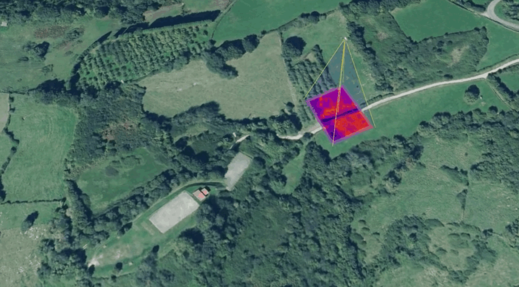
Improve the user experience of aerial cameras with LIVE POSITIONED VIDEO accessible from any device.
Increase the safety of people in any type of mission, by locating all units equipped with a locator on the map in real time.
At Beagle Labs we develop specific software for drones, focused on video processing and positioning.
We innovate to improve the UAV flight experience and facilitate video viewing and mission organization.
In the last decade, drones have become a key technology in the field of emergencies and security and there is still much to be developed.
Founded in 2022, Beagle Labs is made up of a group of professionals passionate about technology, drones and emergency management.
Each of us has a unique experience in software development, product design, AI…

We founded Beagle Labs when we detected a series of problems in aerial video missions:
COORDINATION DIFFICULTY: information is scattered, position, videos, participants… there is no data synchronization.
ORIENTATION DIFFICULTY: Isolated images of the event.
DIFFICULTY OF CONTEXTUALIZATION: Information that comes from different media and is not visual.
We started by placing the drone's live video on a map, soon the map was 3D and we quickly realized the potential of being oriented and located at all times.
With this objective we decided to add a beacon receiver to our product to also be able to place vehicles on the map and thus become a perfect solution for drone operators and emergency management.

Beagle has been selected for the second consecutive year (2023) BFAero, now in the CONSOLIDATION phase.
Business Factory Aero is an initiative of the Xunta de Galicia that offers infrastructure and support to aerospace projects and unmanned vehicles:


Contact us for any tecnical or commercial question.
To provide the best experiences, we and our partners use technologies like cookies to store and/or access device information. Consenting to these technologies will allow us and our partners to process personal data such as browsing behavior or unique IDs on this site and show (non-) personalized ads. Not consenting or withdrawing consent, may adversely affect certain features and functions.
Click below to consent to the above or make granular choices. Your choices will be applied to this site only. You can change your settings at any time, including withdrawing your consent, by using the toggles on the Cookie Policy, or by clicking on the manage consent button at the bottom of the screen.